The Málaga Stereo and Laser Urban Data Set
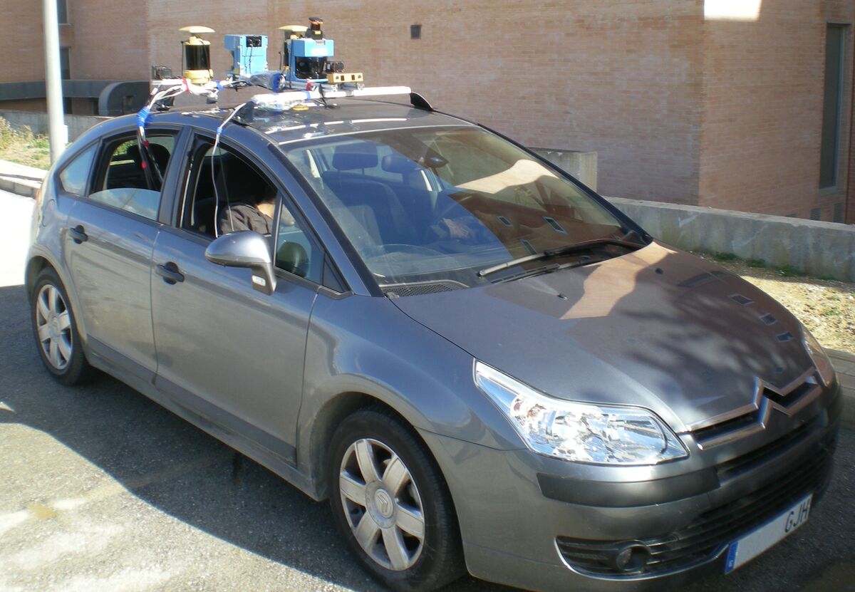
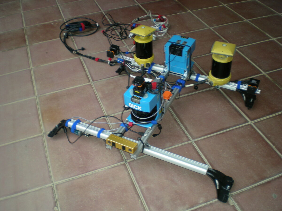
The Málaga Urban Dataset was gathered entirely in urban scenarios with a car equipped with one stereo camera (Bumblebee 2) and five laser scanners, among other sensors. Its distinctive feature is the existence of high-resolution stereo images grabbed at a high rate (20 fps) during a 36.8 km trajectory, which turns it into a suitable benchmark for a variety of computer vision techniques, such as visual odometry, visual SLAM, loop closure and place recognition. Both plain text and binary files are provided, as well as open source tools for working with the binary versions.
Citation and license
Please cite this paper if you use the dataset:
J.L. Blanco-Claraco, F.A. Moreno-Dueñas, J. Gonzalez-Jimenez. “The Málaga Urban Dataset: High-rate Stereo and Lidars in a realistic urban scenario”. The International Journal of Robotics Research (IJRR), 2014, vol. 33, no. 2, pp. 207-214. DOI: 10.1177/0278364913507326 (draft PDF)
BibTeX
@article{blanco2014malaga,
  author    = {Blanco-Claraco, Jos{\'e}-Luis and Moreno-Due{\~n}as, Francisco-{\'A}ngel and Gonz{\'a}lez-Jim{\'e}nez, Javier},
  title     = {The M{\'a}laga Urban Dataset: High-rate Stereo and Lidars in a realistic urban scenario},
  journal   = {The International Journal of Robotics Research},
  volume    = {33},
  number    = {2},
  pages     = {207--214},
  year      = {2014},
  doi       = {10.1177/0278364913507326}
}
This dataset is copyright by us and published under the Creative Commons Attribution CC BY 4.0 License.
Downloads
- Selected extracts: 15 short sections of the dataset, much easier to work with than the entire data. See below.
- Entire dataset: plain text, binary and image packages. See further below.
- Alternative location: the entire dataset is also available in Google Drive, in case the main server is unavailable.
Selected extracts
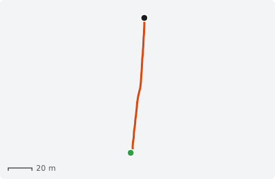
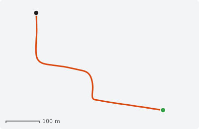
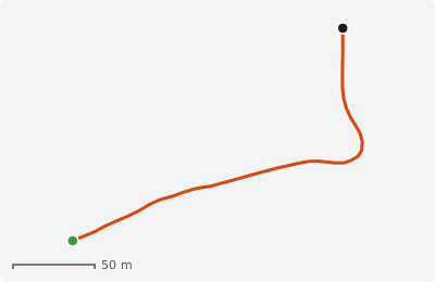
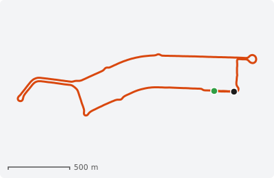
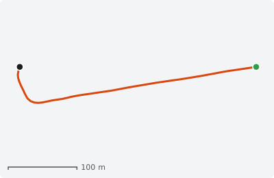
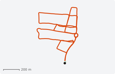
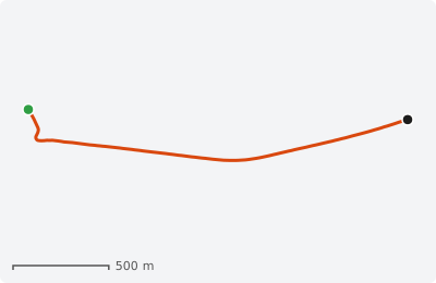
All packages include raw and rectified stereo images, and all data in plain text files and in binary (.rawlog) format. The format is described in the extracts readme. The path of each extract is drawn from its GPS data, with start (green) and end (black) points.
Extract #01
Straight path in the faculty parking lot.
- 0:39 min
- about 115 m
- 789 stereo frames
MD5: 26e3b42112a07ac9e6f7511c850a3b96
Extract #02
Through an under-construction road.
- 1:33 min
- about 590 m
- 1855 stereo frames
MD5: 3f8f5dff44418258cd7715ac8097e477
Extract #03
Roundabout, 3/4 turn.
- 0:41 min
- about 270 m
- 823 stereo frames
MD5: 96ebd8230658267c16fe559a92f5a789
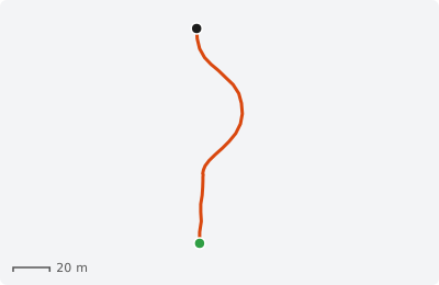
Extract #04
Roundabout with traffic.
- 0:32 min
- about 134 m
- 645 stereo frames
MD5: 386816fa1205b52ddead7c03fd6b88a7
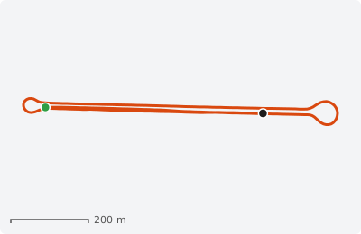
Extract #05
Avenue loop closure (about 1.7 km).
- 4:01 min
- about 2250 m
- 4816 stereo frames
MD5: 7ce7f20cbbf95a1f439213a47d7dabb3
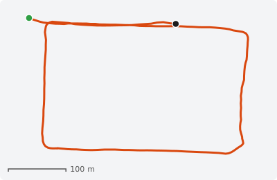
Extract #06
Block loop closure (about 1.2 km).
- 3:51 min
- about 1370 m
- 4618 stereo frames
MD5: c2d39bacaabbd358431544511780be93
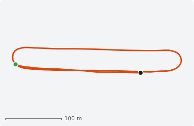
Extract #07
Short avenue loop closure (about 0.7 km).
- 1:46 min
- about 870 m
- 2121 stereo frames
MD5: f461b39e056db34b21c4f769fc6f84ba
Extract #08
Long loop closure (about 4.5 km).
- 8:21 min
- about 4820 m
- 10026 stereo frames
ZIP (11.0 GB) MD5 Log info KML
MD5: 8066602a6cbcd034400c14b8b5ba35cc
Extract #09
Campus boulevard, with traffic.
- 0:51 min
- about 390 m
- 1018 stereo frames
MD5: 3d9ece8bb843c47e0d460a4aa0741a01
Extract #10
Multiple loop closures.
- 14:25 min
- about 5810 m
- 17310 stereo frames
ZIP (18.9 GB) MD5 Log info KML
MD5: bddaadba0810131e276f4564d2ac7365
Extract #11
Highway incorporation, with traffic.
- 2:24 min
- about 2150 m
- 2883 stereo frames
MD5: fe81ff84ce6045f561a41173e73783a8
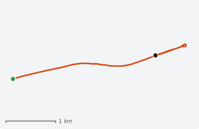
Extract #12
Long avenue with traffic (about 3.7 km).
- 7:23 min
- about 4300 m
- 8861 stereo frames
MD5: 570530062d2890cabd7bfffb91980638
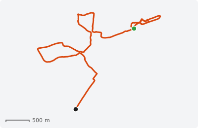
Extract #13
Downtown: traffic and pedestrians.
- 26:12 min
- about 8700 m
- 31443 stereo frames
ZIP (35.5 GB) MD5 Log info KML
MD5: 1b78b79d84bd9cc481984e59a461c6d5
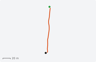
Extract #14
Direct sun example.
- 1:53 min
- about 132 m
- 2259 stereo frames
MD5: 07cd71109380875f1aaecaf9c8c51c2b
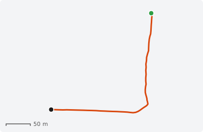
Extract #15
Direct sun example.
- 1:10 min
- about 400 m
- 1397 stereo frames
MD5: 1f9faf5b77885088cac7c3fdc2286170
Entire dataset
| Package | Contents | Size | MD5 |
|---|---|---|---|
| Plain text | Raw laser scans, IMU and GPS data, plus a list of all image file names. See the format readme included. | 1.5 GB | 8806e8c6b7b032310d41cd231d956dca |
| Binary (.rawlog) | The main binary log with all sensors (malaga-urban-dataset_all-sensors.rawlog), a filtered camera + GPS version, and a KML of the path. Open with RawLogViewer, part of MRPT. Raw images are not included in the rawlogs: download them below and place them in a directory named "Images". | 1.4 GB | 32cc0a4f49116ca4d585a7f4e7ddc1e7 |
| Raw images, 1024x768, 20 fps | Unprocessed stereo images in JPEG format (separate left and right files) and the calibration parameters. | 47.7 GB | 5dad0ce7c77aa56d7f86ea16c200d5f4 |
| Rectified images, 1024x768, 20 fps | Rectified stereo images, calibration parameters and a camera + GPS rawlog. | 41.5 GB | d96e84ccd5aab6a3446364b24aafa3ee |
| Rectified images, 800x600, 20 fps | Rectified stereo images, calibration parameters and a camera + GPS rawlog. | 28.7 GB | 88ba785e9d317d01127c13ffd9a0e7c7 |
Calibration parameters of the cameras: raw images, rectified 1024x768 and rectified 800x600. Also available: the calibration and data sheet of the MTi IMU.
Other files
| Package | Contents | Size | MD5 |
|---|---|---|---|
| Stereo calibration images | Image pairs of a checkerboard grabbed with the Bumblebee2 camera, useful to determine the camera rectification parameters. | 10 MB | |
| Video: stereo left (AVI) | Left camera video of the entire dataset. | 3.5 GB | 10b71137e0a08f785c14dcd27475e096 |
| Video: stereo right (AVI) | Right camera video of the entire dataset. | 3.5 GB | 40026fb261b00c64ec0fa29c726f9558 |
| Video: dataset preview (FLV) | Composite preview: camera, GPS position over a city map and a simple 3D reconstruction. | 5.6 GB | dcefbf5baf62dd6df3f9eccee9fc4f21 |
All .rawlog files can be opened with the program RawLogViewer, part of
MRPT. In Ubuntu, install the package mrpt-apps.
Raw (not undistorted) images are not included in the rawlogs: download them separately and put
them in a directory named Images for the software to find them.
Sensors
The vehicle is a Citroën C4 with all the sensors installed in a modified roof rack, so it can drive among the city traffic without restrictions.
| Sensor | Description | Rate |
|---|---|---|
| Stereo camera | Point Grey Bumblebee 2, color, 1024x768 | 20 Hz |
| Laser scanners (3) | Hokuyo UTM-30LX: front (tilted down), left and right (vertical) | 40 Hz |
| Laser scanners (2) | SICK LMS-200: front and rear (horizontal) | about 75 Hz |
| IMU | Xsens MTi | 100 Hz |
| GPS | One receiver, used for the paths shown here | about 2 Hz |
Overall, the dataset has 113,082 stereo frames over 5,655 seconds (about 1.5 hours) and 2.15 million sensor observations.
The sensor labels in the logs are CAMERA1, GPS_DELUO, HOKUYO1, HOKUYO2, HOKUYO3, LASER1, LASER2 and XSensMTi.
Overview of the entire dataset
Path
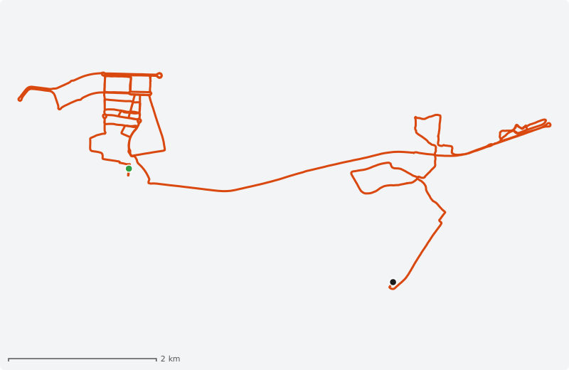
The path obtained from the GPS sensor during the whole dataset run, about 36 km through different urban areas of Málaga (KML file for Google Earth).
Video
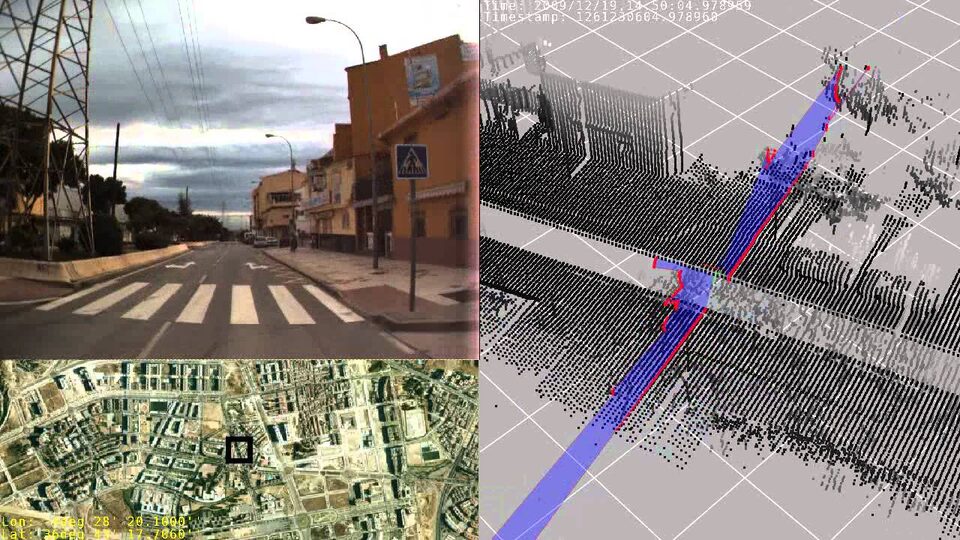
This composition shows: the raw images from the left stereo camera (top-left), the GPS position over a map of the city (bottom-left) and a 3D reconstruction of the environment by simple interpolation of GPS points, using two of the five lasers (right). The exact timestamp is displayed, which is useful to skip to an interesting part for your application.
The video can also be downloaded for offline usage: see Video: dataset preview (FLV) in the table above.
Parsing the logs from C++
Apart from plain text files, binary .rawlog files are an efficient and convenient way of parsing vision and robotic datasets from C++ code. The following example program is a starting point to write your own: parse-dataset-example. Example of usage:
./parse_dataset_example malaga-urban-dataset-extract-01/malaga-urban-dataset-extract-01_rectified_800x600.rawlog
Analysis of the rawlog file
Output of rawlog-edit --info -i malaga-urban-dataset_all-sensors.rawlog for the entire dataset:
Physical file size                : 1.41 GB
Uncompressed file size            : 4.79 GB
Overall number of objects         : 2153717
All sensor labels                 : CAMERA1, GPS_DELUO, HOKUYO1, HOKUYO2, HOKUYO3, LASER1, LASER2, XSensMTi
Sensor (Label/Occurs/Rate/Durat.) :         CAMERA1 / 113082 /19.998 /5654.574
Sensor (Label/Occurs/Rate/Durat.) :       GPS_DELUO /  11244 /1.989 /5653.000
Sensor (Label/Occurs/Rate/Durat.) :         HOKUYO1 / 225416 /39.864 /5654.617
Sensor (Label/Occurs/Rate/Durat.) :         HOKUYO2 / 225631 /39.902 /5654.624
Sensor (Label/Occurs/Rate/Durat.) :         HOKUYO3 / 225510 /39.880 /5654.621
Sensor (Label/Occurs/Rate/Durat.) :          LASER1 / 398531 /74.974 /5315.578
Sensor (Label/Occurs/Rate/Durat.) :          LASER2 / 404487 /73.568 /5498.109
Sensor (Label/Occurs/Rate/Durat.) :        XSensMTi / 549816 /100.000 /5498.150
Changelog
- 2026-11-02: New home of the dataset page (previously at mrpt.org/MalagaUrbanDataset).
- 2019-01-29: The downloads server had technical problems. An alternative location in Google Drive was added.
- 2018-09-13: Fix typo in the "z" coordinate of the front stereo camera: it should be 57 mm, not 273 mm. Table 2 in the draft PDF has been updated accordingly.
- 2017-05-10: Add the calibration and data sheet of the MTi IMU.
- 2014-05-15: All images have been rectified again such that both stereo image centers coincide. This simplifies the number of parameters needed to perform stereo SLAM or visual odometry. Calibration files of rectified images have been updated.
- 2013-10-09: First version online.
Related datasets
- Málaga 2009 Dataset: six outdoor sequences with centimeter-accuracy 6D ground truth.
- GREENBOT Dataset: mobile robot SLAM in a greenhouse.