The Málaga 2009 Robotic Dataset Collection
A Collection of Outdoor Robotic Datasets with centimeter-accuracy Ground Truth. Six datasets recorded in November 2008 at the University of Málaga (Spain) with an electric vehicle equipped with laser scanners, color cameras, an IMU and three RTK GPS receivers. The 6D path of the vehicle, together with its uncertainty, is estimated from the RTK data, so the collection is a test bed for visual SLAM, 2D SLAM, visual odometry and localization methods. Reference 3D point clouds built from the lasers are provided as well.
Download status (2 November 2026). The original files were hosted in SourceForge and are no longer available there. PARKING-0L is available again (restored from the author's archive), together with the stereo calibration images. The other five sequences (PARKING-2L, PARKING-6L, CAMPUS-0L, CAMPUS-2L and CAMPUS-RT) are currently unavailable. Their original MD5 sums are listed below, to help verifying any copy you may have downloaded in the past. If you need one of them, please contact me.
Paper, citation and license
Please cite this paper if you use the datasets:
J.L. Blanco, F.A. Moreno, J. Gonzalez. “A Collection of Outdoor Robotic Datasets with centimeter-accuracy Ground Truth”. Autonomous Robots, 2009, vol. 27, no. 4, pp. 327-351. DOI: 10.1007/s10514-009-9138-7 (draft PDF)
BibTeX
@article{blanco2009cor,
  author  = {Blanco, Jos{\'e}-Luis and Moreno, Francisco-Angel and Gonz{\'a}lez, Javier},
  title   = {A Collection of Outdoor Robotic Datasets with centimeter-accuracy Ground Truth},
  journal = {Autonomous Robots},
  volume  = {27},
  number  = {4},
  pages   = {327--351},
  month   = {November},
  year    = {2009},
  issn    = {0929-5593},
  doi     = {10.1007/s10514-009-9138-7}
}
These datasets are copyright by us and published under the Creative Commons Attribution CC BY 4.0 License.
Abstract. The lack of publicly accessible datasets with a reliable ground truth has prevented in the past a fair and coherent comparison of different methods proposed in the mobile robot Simultaneous Localization and Mapping (SLAM) literature. Providing such a ground truth renders specially challenging in the case of visual SLAM, where the world model is 3-dimensional and the robot path is 6-dimensional. This work addresses both the practical and theoretical issues found while building a collection of six outdoor datasets. It is discussed how to estimate the 6-d vehicle path from readings of a set of three Real Time Kinematics (RTK) GPS receivers, as well as the associated uncertainty bounds that can be employed to evaluate the performance of Visual SLAM methods. The vehicle was also equipped with several laser scanners, from which reference point clouds are built as a test-bed for other algorithms such as segmentation or surface fitting. All the datasets, calibration information and associated software tools are available for download.
Errata (updated March 2012)
- Figure 1(b) shows the IMU mounted upside down, while it was actually mounted right-side up. See the pictures below. The yaw, pitch and roll angles given in Table 1 are correct: it was only an issue with the figure.
- Equation (30) in appendix I fails to mention that adding the angles is only a valid approximation for small rotations.
Dataset downloads
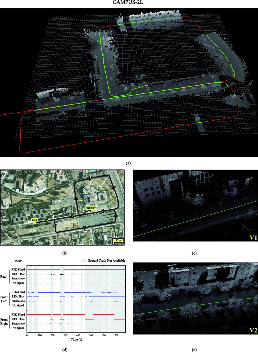
The collection has two locations: the parking of the Computer Science School (PARKING-0L, 2L and 6L, with almost planar paths, trees, cars and loops) and the campus boulevard (CAMPUS-0L, 2L and RT, with long straight sections and large loops). In five of the sequences the suffix is the number of complete loops (0L means zero loops), while in CAMPUS-RT it means round trip. Click on a preview to see the full overview figure of the sequence: 3D point cloud, aerial view of the path, and GPS operation modes. The suitability tags follow the summary table of the paper.
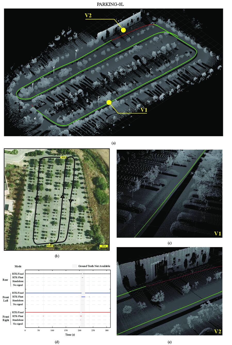
PARKING-0L
Almost planar path through the parking lot of the Computer Science School, among trees and cars. A single pass with no loops.
524 m · 4:16 min · 1922 stereo pairs
- Loop closure
- Visual SLAM
- 2D SLAM
- Visual odometry
- Dynamic objects
malaga2009_parking_0L.zip (1.4 GB) MD5 README
MD5: 696ddbfae90cb980b895046bd62f3d03
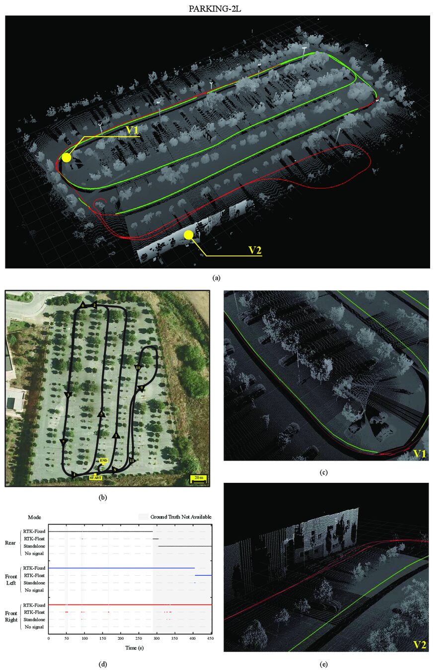
PARKING-2L
Same parking lot, with two complete loops: a good test for loop closure in SLAM.
543 m
- Loop closure
- Visual SLAM
- 2D SLAM
- Visual odometry
- Dynamic objects
Download currently unavailable. README
Original package data
Original file malaga2009_parking_2L.zip, 2.1 GB.
MD5: 88d54558dd0f00a9df435c99711e3b5a
Useful to verify a copy downloaded in the past.
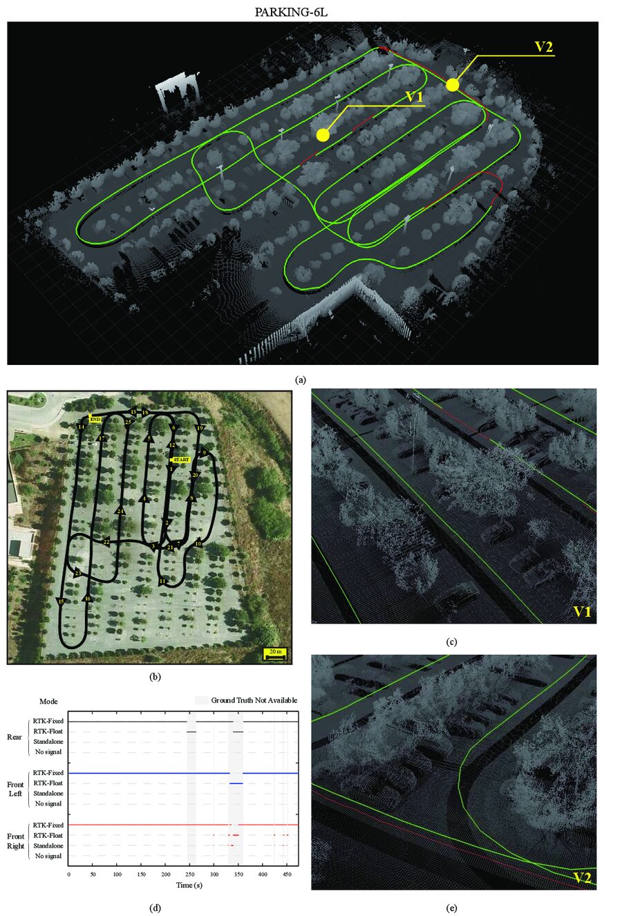
PARKING-6L
Same parking lot, with six complete loops, plus moving cars and crossing people.
1222 m
- Loop closure
- Visual SLAM
- 2D SLAM
- Visual odometry
- Dynamic objects
Download currently unavailable. README
Original package data
Original file malaga2009_parking_6L.zip, 2.3 GB.
MD5: 3273fc6b011dc6395927097ebba0a9c2
Useful to verify a copy downloaded in the past.
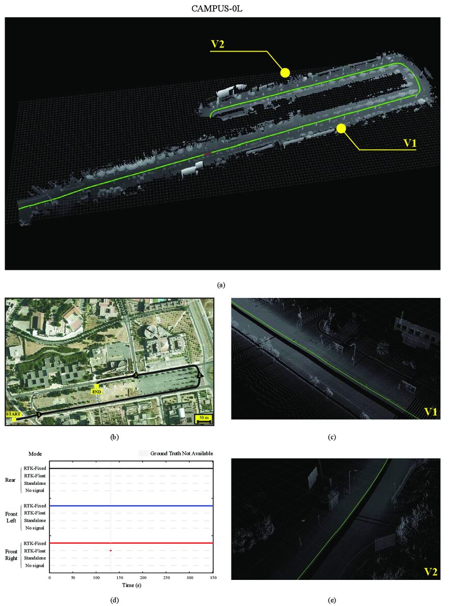
CAMPUS-0L
Long straight sections along the campus boulevard of the University of Málaga, ending with a 180 degree turn.
1143 m
- Loop closure
- Visual SLAM
- 2D SLAM
- Visual odometry
- Dynamic objects
Download currently unavailable. README
Original package data
Original file malaga2009_campus_0L.zip, 1.8 GB.
MD5: 030ddf2d0ac15c836fdfb549823795c3
Useful to verify a copy downloaded in the past.
CAMPUS-2L
Large loops around the campus, driven twice: for large-scale SLAM validation.
2150 m
- Loop closure
- Visual SLAM
- 2D SLAM
- Visual odometry
- Dynamic objects
Download currently unavailable. README
Original package data
Original file malaga2009_campus_2L.zip, 3.6 GB.
MD5: 95aa661466d30c2b845d6c5df58d2e42
Useful to verify a copy downloaded in the past.
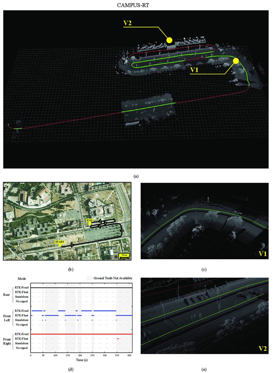
CAMPUS-RT
A round trip along the campus boulevard (RT stands for round trip).
776 m
- Loop closure
- Visual SLAM
- 2D SLAM
- Visual odometry
- Dynamic objects
Download currently unavailable. README
Original package data
Original file malaga2009_campus_RT.zip, 1.9 GB.
MD5: b2f812b7e722373efa3e5792bb51ab89
Useful to verify a copy downloaded in the past.
What each package contains
<name>.rawlog: binary log with all the sensor data, in MRPT rawlog format.Images,Images_rect: raw and rectified images of the left and right cameras.GT_path_vehicle.txt: ground-truth 6D pose of the vehicle at 1 Hz, with its covariance.GT_path_vehicle_interp.txt: interpolated at 100 Hz. Also asGT_path_vehicle.bin.gzfor C++/MRPT, and one file per sensor (GT_path_<sensor>.txt).GT_path_vehicle_confidence.txt: quality measure of the ground truth at each instant.W_star_cov_matrix.txt: reference covariance matrix of the estimated path.pointcloud.txt,pointcloud.3Dscene,pointcloud_img.png: 3D point cloud from the two vertical SICK scanners and their ground-truth path.malaga_datasets_grabber.ini: 6D pose of every sensor on the vehicle, camera parameters and other settings.README.html: full description of the format. Rotations are given as yaw, pitch and roll.
The README of each sequence is also available online from its card above. Most data are plain text and image files, so they can be read from MATLAB or any other software.
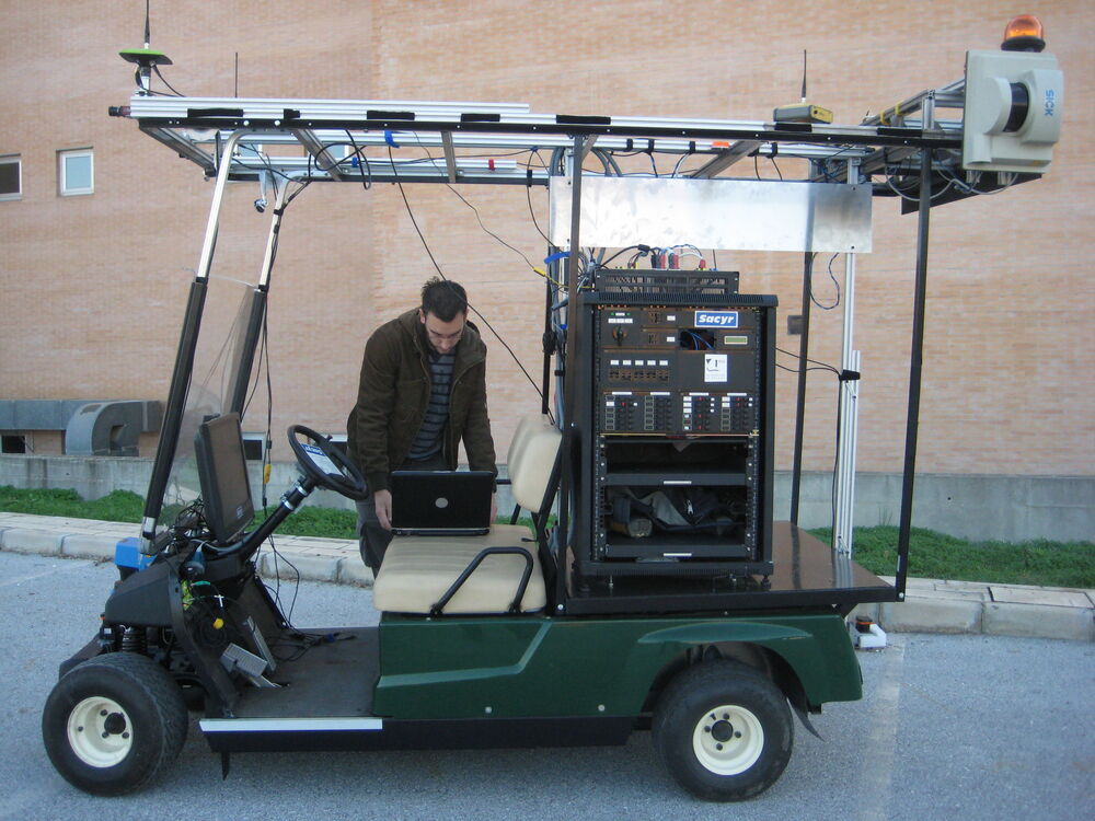
Vehicle and sensors
- 3 SICK laser scanners (two LMS-221 and one LMS-200) and 2 Hokuyo UTM-30LX.
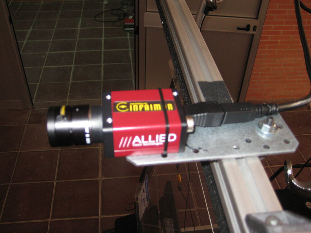
- 2 FireWire color cameras (1024x768 at 7.5 fps).
- 1 Xsens MTi inertial measurement unit (100 Hz).
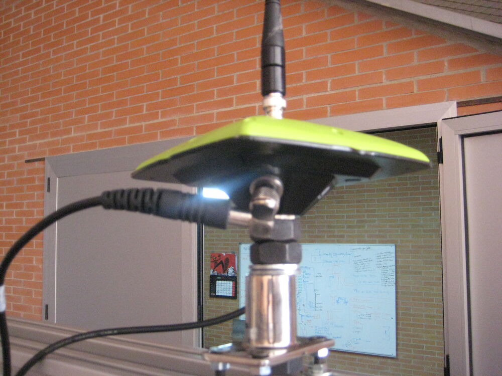
- 3 RTK GPS receivers, used to compute the ground truth, and 1 consumer-grade USB GPS receiver.
As an example, PARKING-0L has 1,922 stereo pairs, 256 seconds of data and about 65,000 sensor observations in its rawlog.
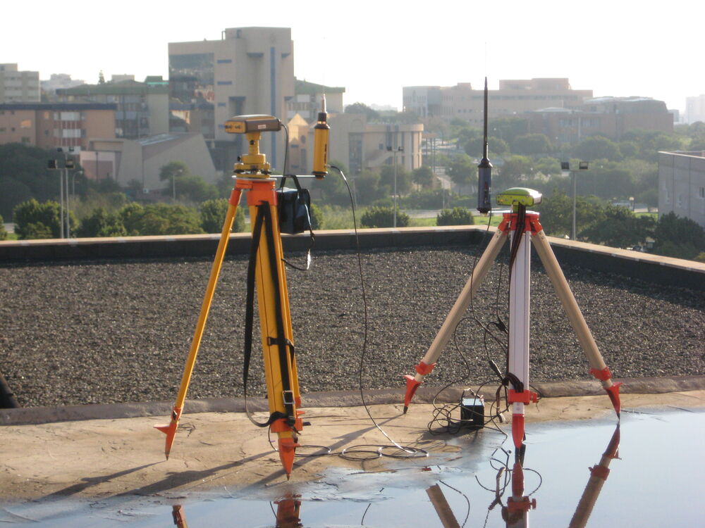
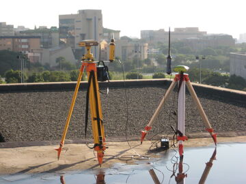 GPS antennas on tripods, with the city in the background
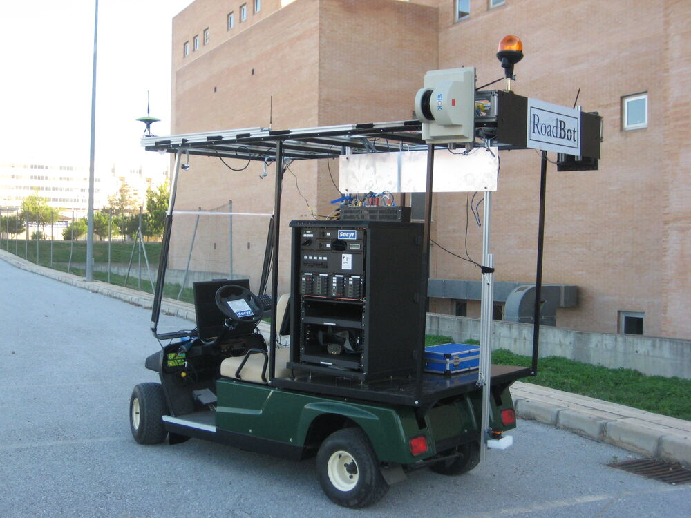
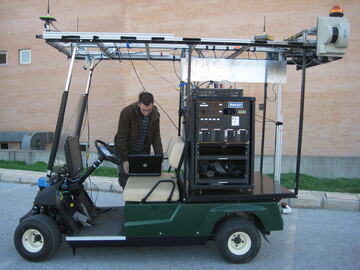 The vehicle with the sensor roof frame
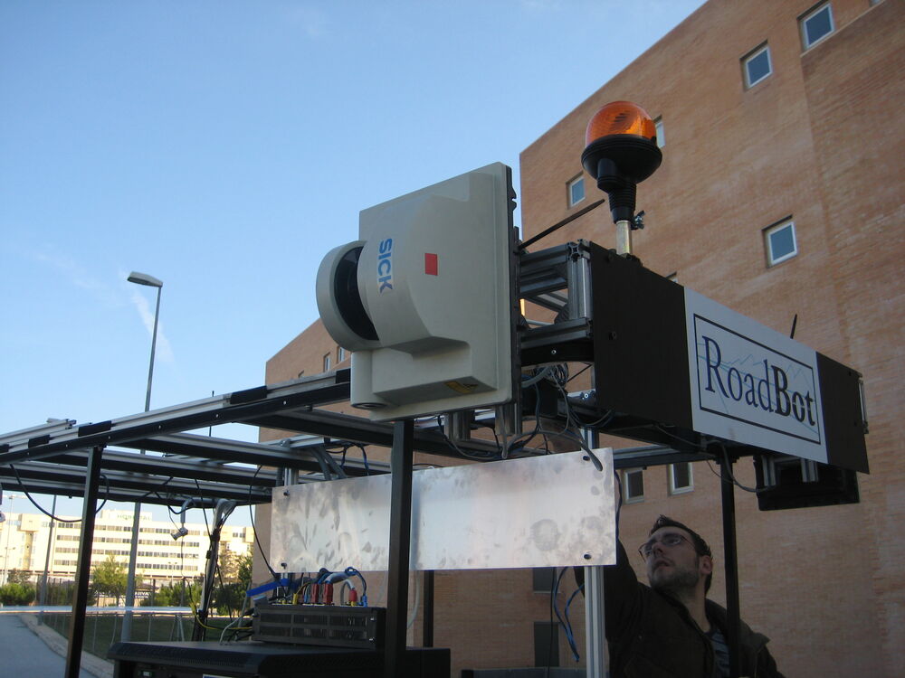
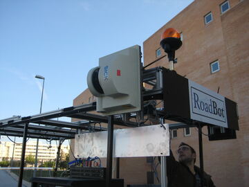 A laser scanner mounted on the roof frame
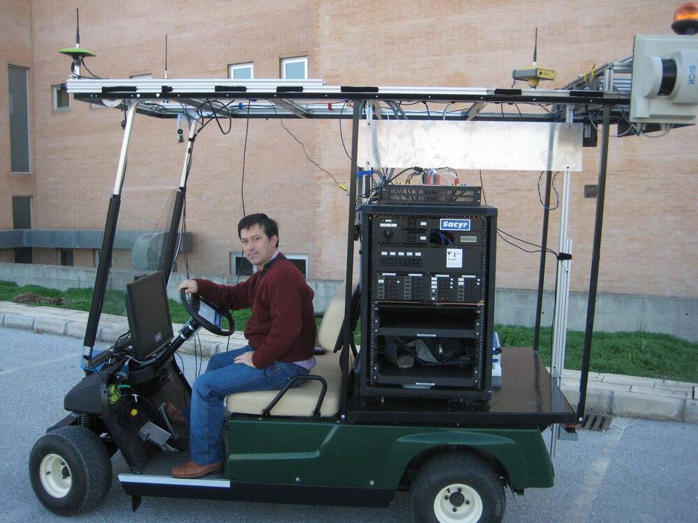
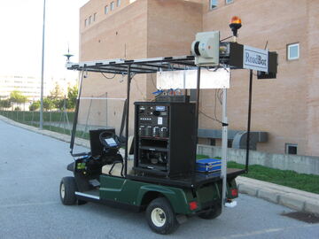 The vehicle and its roof frame, side view
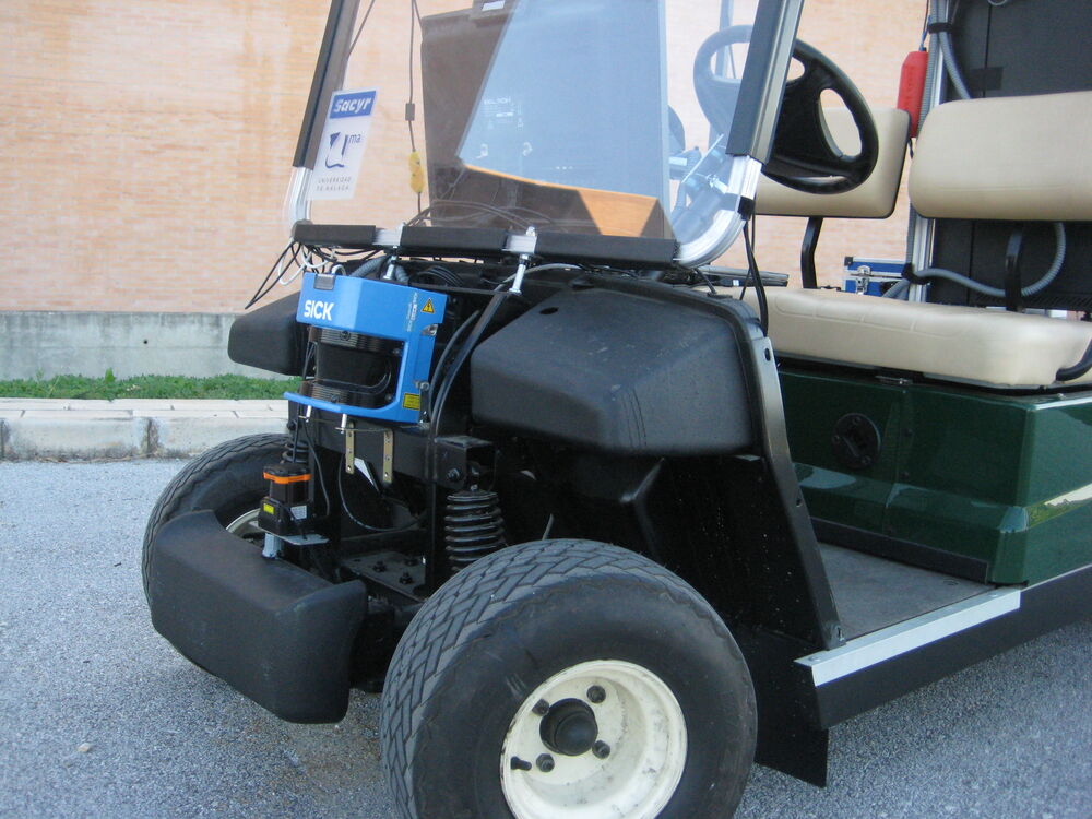
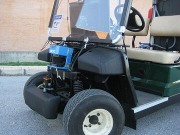 A laser scanner mounted at the front of the vehicle
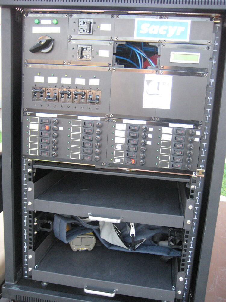
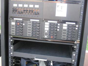 The on-board computers and electronics rack
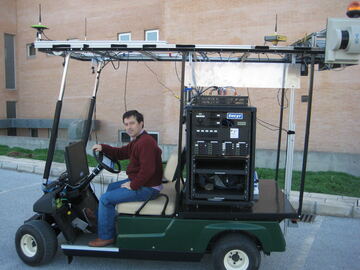 The vehicle with its driver
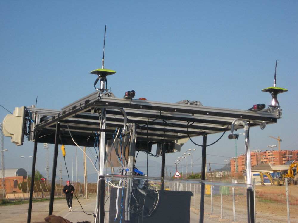
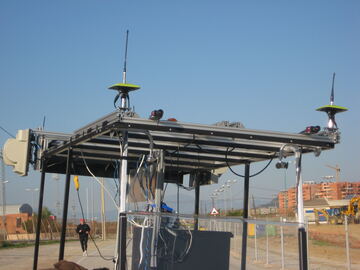 The roof frame with GPS antennas, seen from below
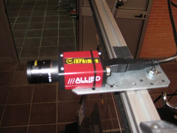 One of the cameras mounted on the roof frame
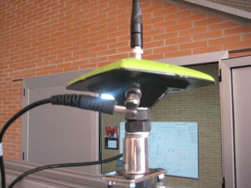 A GPS antenna on the roof frame
Software
The following MRPT applications were used to elaborate the article:
rawlog-grabber to record the datasets in the vehicle, and
RawLogViewer to inspect and filter the raw datasets and to generate the
ground-truth estimates. RawLogViewer can also be used directly with the downloaded datasets. In Ubuntu and Debian, install the package mrpt-apps.
Camera calibration
A set of stereo image pairs of a 5x8 checkerboard with squares of 12x12 cm, which can be used to calibrate the cameras or to rectify the images.
The original file in SourceForge was malaga2009_imgs_stereo_calib.zip; this package was rebuilt from the author's archive.
| Package | Contents | Size | MD5 |
|---|---|---|---|
| Stereo camera calibration images | Image pairs of a 5x8 checkerboard (squares of 12x12 cm), with the calibration results, to calibrate the cameras or rectify the images. | 4 MB | f2426a76933deb21b3a357faf3ca89d1 |
Extra material
Selected material from the preparation of the paper, which may have historical value: LaTeX sources and EPS figures of the manuscript, overview figures of each sequence, pictures of the vehicle and sensors taken in November 2008, sensor pose measurements and notes.
| Package | Contents | Size | MD5 |
|---|---|---|---|
| Extra material: manuscript sources, figures and photos | LaTeX sources and EPS figures of the paper, per-sequence overview figures, sensor photos taken in November 2008, calibration notes and sensor pose measurements. | 149 MB | 9617fdbe7fda900df102db3f84d7b0ed |
Related datasets
- Málaga Urban Dataset: the follow-up, with a stereo camera and five laser scanners in real urban traffic.
- GREENBOT Dataset: mobile robot SLAM in a greenhouse.
Changelog
- 2026-11-02: New home of the dataset page (previously at mrpt.org/malaga_dataset_2009). PARKING-0L and the calibration images are available again; the other five sequences are unavailable.
- 2012-03: Errata added.
- 2009-11: Paper published and datasets released.