Husky UAL LiDAR-Inertial Dataset: a mobile robot on a university campus
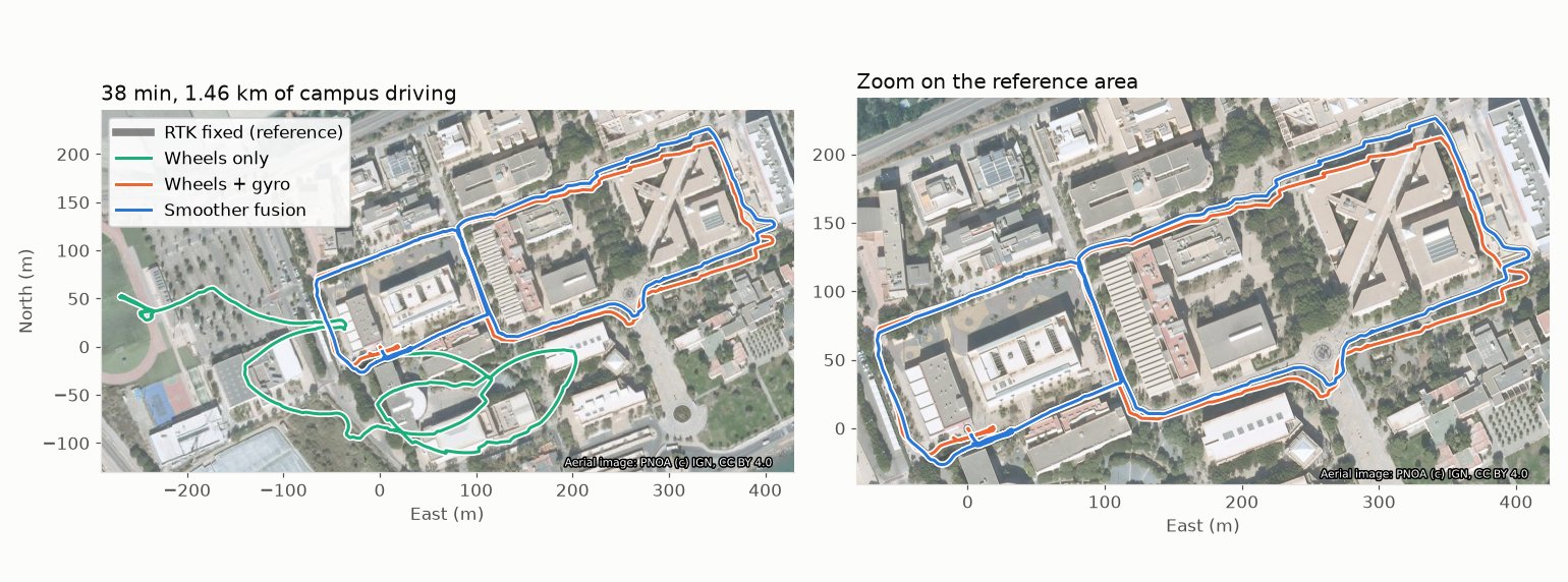
Sequences recorded with a Clearpath Husky A200 mobile robot driving around the campus of the University of Almería (Spain), for benchmarking LiDAR and LiDAR-inertial odometry, SLAM, localization and multi-sensor fusion with GNSS.
The robot carries an Ouster OS0-32 and a Velodyne VLP-16 LiDAR, a Bumblebee2 stereo camera, two IMUs (a HandsFree 9-axis unit and the Ouster's own), wheel odometry, a u-blox ZED-F9P RTK GNSS receiver with NTRIP corrections (centimeter-level ground truth while in RTK fixed) and a low-cost u-blox 7 receiver. All data is recorded with ROS 2 Jazzy as MCAP bags. The robot PC clock follows the GNSS time pulse and the Ouster is synchronized by PTP, so all stamps are UTC.
Sequences are released progressively, each with the subset of sensors that is ready. The first one has no LiDAR data: it is the dataset of the MOLA tutorial on fusing wheel odometry, IMUs and RTK GNSS.
Sequences
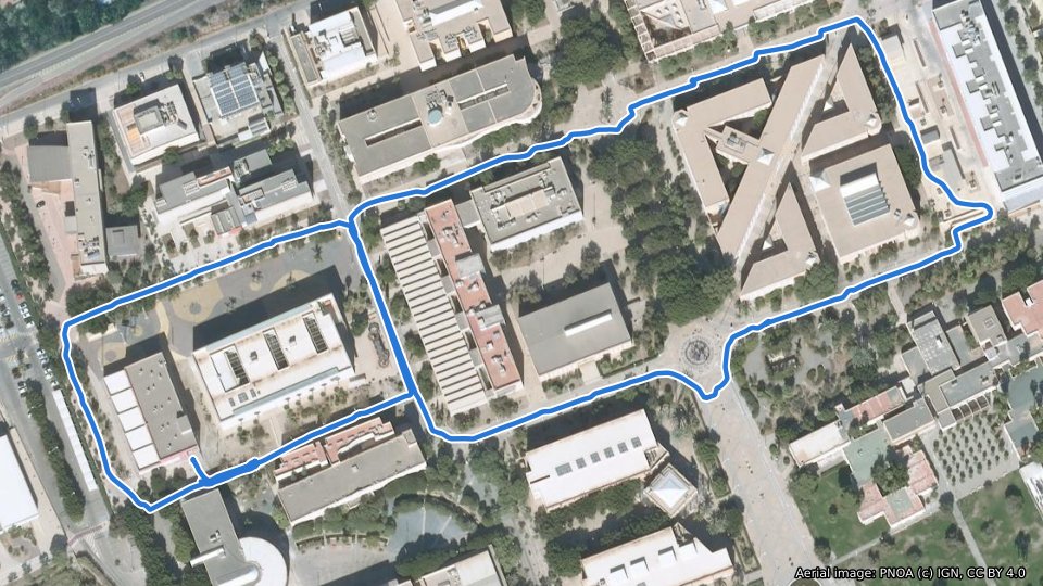
2026-11-16 campus loop
Wheel odometry, two IMUs, RTK GNSS (u-blox ZED-F9P) and a low-cost GNSS. No LiDAR or cameras in this release.
2026-11-16 · 37:46 min · 1.46 km · ROS 2 bag (MCAP)
Download (zip, 69 MB) Files and scripts README Tutorial
MD5 f69647e4e99205cf72c6f89cf2d9918a
Each release folder has a README with the topics, sensor poses, timing details and known issues of the sequence.
Tutorial: wheels + IMU + RTK GNSS fusion with MOLA
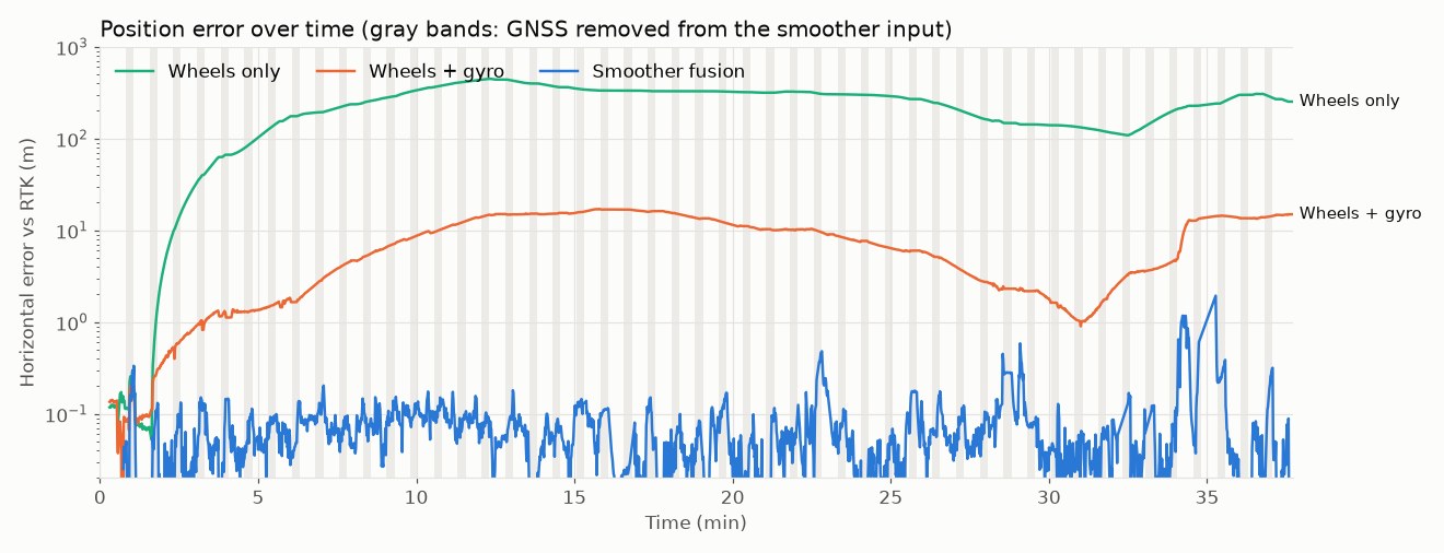
The MOLA tutorial on the first sequence shows how to fuse wheel odometry, the gyroscopes of one or two IMUs and RTK GNSS with the MOLA state estimation smoother, keeping a centimeter-level, geo-referenced pose while the GNSS is lost for a while. With the GNSS removed 15 s of every 45 s, the median horizontal error against RTK is 5.5 cm, while wheel odometry alone ends hundreds of meters away:
The tutorial is also available as a short video:
The tutorial scripts (replay, simulated GNSS outages and evaluation against RTK) are in the release folder.
License
All sequences are released under the Creative Commons Attribution 4.0 International license (CC BY 4.0): you may share and adapt them for any purpose, including commercially, as long as you give appropriate credit. The tutorial scripts are BSD 3-Clause, like MOLA.
Citation
If you use this dataset, please cite it as:
J.L. Blanco-Claraco. “Husky UAL LiDAR-Inertial Dataset”. University of Almería, 2026. https://w3.ual.es/~jlblanco/datasets/husky-ual-lidar-inertial-dataset/
BibTeX
@Misc{blanco2026husky,
  AUTHOR = {Blanco-Claraco, Jose Luis},
  TITLE = {Husky {UAL} {LiDAR}-Inertial Dataset},
  HOWPUBLISHED = {\url{https://w3.ual.es/~jlblanco/datasets/husky-ual-lidar-inertial-dataset/}},
  YEAR = {2026}
}
Changelog
- 2026-11-17: First sequence (2026-11-16 campus loop): wheel odometry, IMUs and GNSS, with the MOLA fusion tutorial.
Privacy
If you find yourself or personal belongings in this dataset and feel unwell about it, please get in touch and we will remove the respective data.
Related datasets
- Málaga 2009 Dataset: outdoor sequences with centimeter-accuracy 6D ground truth.
- GREENBOT Dataset: LiDAR SLAM in a Mediterranean greenhouse.