|
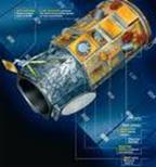
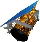
With the launch of the first very high resolution (VHR) satellites, IKONOS in September 1999, with 1m as the nominal ground sample distance (GSD) in panchromatic, and QuickBird in October 2001, with 0.61m as the nominal GSD, conventional aerial photogrammetric mapping at large scales began to have serious competitors. Besides, many new VHR satellites, capable of capturing panchromatic imagery of the land surface with GSD of 1 m and even lower, such as EROS B1, Resurs DK-1, KOMPSAT-2, IRS Cartosat 2, WorldView-1, have been launched during 2006 and 2007, and they are offering to theirs customers very high resolution imagery of the Earth, with a revisit time very shortly. The rapid increase of commercial VHR satellites in the next few years will result in improvements in resolution, availability and cost. In 2008, and with the cooperation of the U.S. Department of Defence, was launched a new commercial VHR satellite called GeoEye-1 (GeoEye, Inc.), which, nowadays, is the commercial satellite with the highest geometric resolution, in panchromatic (0.41 m) and in multispectral (1.65 m) products. More recently, on January 4, 2010, have begun to commercialize imagery of the last of the VHR satellites launched. It is WorldView-2 (DigitalGlobe, Inc.), whose more relevant technical innovation is the radiometric accuracy improvement, since the number of bands that compose its multispectral image are increased to 8, instead of the 4 classic bands (R, G, B, NIR) of all the previous VHR satellites. The main objective of the project is to study the actual accuracy and quality obtained, in operational conditions, in the geo-referenced information (orthoimages, digital elevation models (DEMs) and maps compiled from detected objects gathered by classification software) generated from imagery of the commercial VHR satellites more innovative and unexplored, i.e., GeoEye-1 and WorldView-2. These new VHR satellites offer important improvements related to resolution both spatial and spectral, compared with its predecessors. Therefore a sensitive improvement may be expected in: (i) the geometric accuracies obtained in orthoimages and DEMs generated from scenes of GeoEye-1 and WorldView-2, as well as, (ii) an increase in the accuracy of the objects classification (urbanizations, buildings, highways, impervious areas, crops), owed to the higher number of bands that compose the multispectral image of WorldView-2. These potential improvements will have to be contrasted with real tests in fields conditions, studying the ideal and optimised methodologies for the generation of geo-referenced information as accuracy as possible. The geo-referenced data generated from VHR satellite scenes present important capabilities headed-up to objects classification, specially in coastal zones (e.g., using of the Coastal Blue band from WorldView-2 for obtaining near shore bathymetry). Hence they will be used for the monitoring and modelling of the evolution and vulnerability of the coastal fringe placed between Garrucha and Villaricos (Almería), where the construction of an artificial channel of the river Almanzora and the proliferation of urbanizations during the last 50 years have provoked serious natural disasters, e.g., the loss of about 200 m of beach at Quitapellejos area (Palomares). |


|
Abstract Proyecto Plan Nacional 2010. |

|
Dr. Manuel Ángel Aguilar Torres Investigador Principal
Teléfono: 950 015997 Fax: 950 015491 Correo: maguilar@ual.es |
|
Información de contacto: |

|
Proyecto de Investigación Fundamental No Orientada. CTM2010-16573: “Generación de datos georreferenciados de muy alta resolución a partir de imágenes de los satélites GeoEye-1 y WorldView-2” |